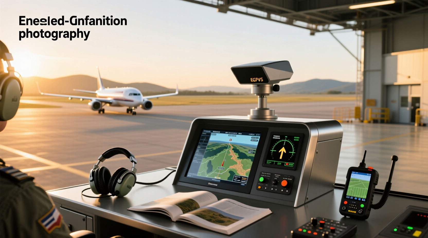
✈️ An enhanced ground proximity warning system (EGPWS) is a critical aviation safety technology designed to prevent controlled flight into terrain (CFIT) by providing pilots with timely alerts when an aircraft is at risk of colliding with the ground or obstacles. Unlike basic GPWS, EGPWS integrates GPS data, digital terrain databases, and advanced predictive algorithms to deliver earlier, more accurate warnings—giving flight crews crucial seconds to react. This article explores how EGPWS works, its components, operational benefits, limitations, and real-world applications across commercial and private aviation sectors.
Understanding the Basics: What Is EGPWS?
The enhanced ground proximity warning system evolved from the original Ground Proximity Warning System (GPWS), which was introduced in the 1970s after a series of fatal CFIT incidents. While traditional GPWS relied on radio altimeters to measure height above terrain directly below the aircraft, it had limited foresight and often provided warnings too late for effective recovery.
EGPWS, also known as Terrain Awareness and Warning System (TAWS), overcomes these shortcomings by combining multiple data sources:
- Global Positioning System (GPS) for precise location tracking
- Inertial Reference Units (IRU) for attitude and movement data
- Digital Elevation Models (DEM) containing global terrain and obstacle databases
- Barometric altitude and radar altimeter inputs
- Flight path prediction algorithms
This integration allows EGPWS to project the aircraft’s future flight path and compare it against stored terrain profiles up to several minutes ahead, significantly improving situational awareness.
How Does EGPWS Work? A Step-by-Step Breakdown
⚙️ The operation of an enhanced ground proximity warning system involves continuous monitoring and real-time analysis of multiple aircraft parameters. Here's how it functions during a typical flight phase:
- Data Collection: Sensors gather information including current position, altitude, vertical speed, heading, pitch, roll, and flap/gear status.
- Terrain Comparison: The system cross-references the aircraft’s projected trajectory with onboard terrain and obstacle databases.
- Hazard Detection: If the predicted flight path intersects with terrain or man-made structures within a predefined time window (e.g., 30–60 seconds), potential threats are identified.
- Alert Generation: Based on severity and timing, the system issues visual and audible warnings such as “TERRAIN AHEAD,” “PULL UP,” or “OBSTACLE AHEAD.”
- Crew Response: Pilots initiate corrective maneuvers based on standard operating procedures.
These alerts are prioritized and categorized into different levels of urgency, ensuring that only actionable warnings reach the cockpit without overwhelming the crew.
Key Features of Modern EGPWS Implementations
✨ Today’s EGPWS platforms offer several advanced capabilities beyond basic terrain avoidance:
| Feature | Description | Operational Benefit |
|---|---|---|
| Forward-Looking Terrain Alerting (FLTA) | Predicts terrain conflicts ahead of the aircraft using GPS and DEM | Provides early warning in mountainous or complex approach environments |
| Obstacle Database Integration | Includes man-made hazards like towers, wind farms, and buildings | Reduces risk during low-altitude operations near urban areas |
| Runway Environment Awareness | Monitors approach stability and landing configuration | Triggers alerts for unsafe descent rates or gear not down |
| Minimum Safe Altitude Warning (MSAW) | Compares actual altitude with sector-specific minimums | Supports ATC coordination and en-route safety |
| Customizable Alert Thresholds | Allows operators to adjust sensitivity based on fleet type or region | Balances alert accuracy with nuisance reduction |
Common Warning Modes and Pilot Responses
🚨 EGPWS generates standardized audio and visual alerts based on International Civil Aviation Organization (ICAO) and Federal Aviation Administration (FAA) guidelines. Each mode corresponds to a specific flight scenario:
- Mode 1 – Excessive Descent Rate: "SINK RATE, SINK RATE" followed by "PULL UP" if uncorrected
- Mode 2 – Excessive Terrain Closure Rate: "TERRAIN, TERRAIN" then "PULL UP"
- Mode 3 – Altitude Loss After Takeoff or Go-Around: "DON’T SINK"
- Mode 4 – Unsafe Terrain Clearance: "TOO LOW – TERRAIN" or "TOO LOW – GEAR" depending on configuration
- Mode 5 – Glide Slope Deviation: "GLIDESLOPE" repeated until corrected
- Mode 6 – Advisory Callouts: Includes bank angle, decision height, and altitude callouts
Pilots are trained to respond immediately to “PULL UP” commands, typically executing a maximum-performance climb while retracting flaps/slats and confirming engine thrust settings.
Where Is EGPWS Required? Regulatory Landscape
🌐 Regulatory mandates for enhanced ground proximity warning systems vary by jurisdiction and aircraft category. In general:
- Commercial Airlines (Part 121): FAA requires all turbine-powered airplanes with six or more passenger seats to be equipped with TAWS-compliant systems (which includes EGPWS). Similar rules apply under EASA in Europe.
- Corporate & Private Jets: Mandatory for most business aircraft operating under Part 91K or fractional ownership programs.
- Helicopters: Since 2014, new helicopters used in offshore oil transport, emergency medical services (EMS), and law enforcement must have Class A TAWS installed.
- General Aviation: Not universally required but strongly recommended, especially for aircraft flying in mountainous regions or conducting instrument approaches.
Operators should consult local aviation authorities such as the FAA 1, EASA 2, or Transport Canada for equipment requirements specific to their airworthiness certificate and operational rules.
Advantages Over Traditional GPWS
✅ The transition from basic GPWS to EGPWS has delivered measurable improvements in aviation safety:
- Reduced False Alarms: By incorporating forward-looking logic, EGPWS avoids nuisance warnings common in valleys or descending approaches where terrain rises beneath the aircraft.
- Earlier Warnings: Predictive modeling enables alerts up to two minutes before potential impact, compared to seconds with legacy systems.
- Better Obstacle Coverage: Databases include thousands of man-made obstructions not detectable via radar altimeter alone.
- Improved Situational Awareness: Cockpit displays can show color-coded terrain maps, enhancing spatial understanding.
- Integration with Flight Displays: Many modern avionics suites overlay terrain data directly onto Primary Flight Displays (PFD) or Multi-Function Displays (MFD).
Studies by the National Transportation Safety Board (NTSB) indicate that widespread adoption of EGPWS has contributed to a significant decline in CFIT accidents since the early 2000s 3.
Limits and Known Limitations of EGPWS
❗ Despite its sophistication, EGPWS is not infallible. Users must understand its constraints:
- Dated Terrain Databases: Obstacles constructed after the last database update may not appear. Operators must ensure regular updates (typically every 28 days).
- No Real-Time Weather Integration: Cannot account for rapidly changing conditions like volcanic ash clouds or sudden fog banks.
- Dependence on GPS Integrity: Signal jamming or spoofing can degrade performance, though dual-system installations mitigate this risk.
- Not a Substitute for Crew Vigilance: Automation complacency remains a concern; pilots must maintain manual flying skills and cross-check navigation sources.
- Urban Canyon Effects: In dense city environments, GPS signal reflection may reduce positional accuracy.
Maintaining updated software, proper installation alignment, and crew training are essential to maximizing system reliability.
Installation and Maintenance Considerations
🔧 Integrating EGPWS into an aircraft involves more than just installing hardware. Key steps include:
- System Compatibility Check: Verify compatibility with existing avionics (e.g., FMS, ADIRU, transponder).
- Antenna Placement: GPS and radar altimeter antennas must be positioned to minimize interference and blockage.
- Database Loading: Install current terrain and obstacle databases using secure media or wireless upload methods.
- Calibration & Testing: Perform functional checks including simulated approach profiles and failure modes.
- Crew Training: Ensure pilots understand alert meanings, response protocols, and system limitations.
Ongoing maintenance includes periodic inspection of sensors, verification of database currency, and logging any false or missed alerts for review.
EGPWS in Different Aircraft Types and Operations
🚚 While most associated with large airliners, EGPWS is increasingly adopted across diverse platforms:
- Airliners: Integrated into full glass cockpits with synthetic vision systems (SVS) for enhanced depth perception.
- Business Jets: Often combined with weather radar and traffic collision avoidance systems (TCAS) in integrated safety suites.
- Regional Turboprops: Retrofit kits available for older models operating in challenging environments like Alaska or the Andes.
- Military Aircraft: Modified versions used in low-level flight training and combat missions, sometimes with encrypted terrain data.
- Unmanned Aerial Vehicles (UAVs): Emerging use in autonomous drones requiring terrain-aware navigation.
Each application requires tailored configuration to match mission profiles and regulatory standards.
Debunking Common Misconceptions About EGPWS
📌 Several myths persist about enhanced ground proximity warning systems. Clarifying these helps users make informed decisions:
- Myth: EGPWS Prevents All Terrain Collisions.
Reality: It reduces risk but cannot guarantee avoidance if pilots ignore alerts or encounter unexpected failures.
- Myth: Only Large Aircraft Need EGPWS.
Reality: General aviation pilots benefit significantly, especially during night or IMC flights in unfamiliar areas.
- Myth: The System Works Automatically Without Updates.
Reality: Terrain databases require regular updates—failure to do so compromises safety.
- Myth: EGPWS Replaces Pilot Judgment.
Reality: It supports decision-making but does not replace fundamental airmanship or proper flight planning.
Future Trends in Terrain Avoidance Technology
🌐 Ongoing advancements aim to further enhance the capabilities of proximity warning systems:
- Real-Time Data Feeds: Integration with ADS-B and satellite-based augmentation systems (SBAS) for dynamic hazard reporting.
- Artificial Intelligence: Machine learning models analyzing historical accident patterns to refine alert thresholds.
- Synthetic Vision Enhancement: 3D terrain rendering overlaid on head-up displays (HUD) or augmented reality interfaces.
- Drone Traffic Integration: Future urban air mobility (UAM) vehicles may rely on networked EGPWS-like systems for automated terrain and structure avoidance.
- Open Standards Development: Efforts underway to standardize terrain data formats across manufacturers and regions.
As airspace becomes more congested and autonomous operations expand, robust terrain awareness will remain a foundational layer of flight safety.
How to Evaluate EGPWS Performance During Pre-Flight Checks
📋 Pilots and maintenance technicians can verify system readiness through structured procedures:
- Confirm EGPWS status light is green on the overhead panel.
- Review recent database update date via system menu.
- Check MFD/PFD for correct terrain display upon power-up.
- Listen for startup chime and self-test completion tone.
- Verify no active fault messages in the central maintenance computer.
- Ensure GPS and inertial systems are aligned before engine start.
If any anomalies are detected, defer flight until resolved by certified personnel.
Frequently Asked Questions (FAQs)
❓ Here are answers to common questions about enhanced ground proximity warning systems:
What is the difference between GPWS and EGPWS?
Basic GPWS uses only radar altimeter data to warn of immediate terrain contact, while EGPWS adds GPS positioning and digital terrain databases to predict future conflicts, offering earlier and more accurate alerts.
How often should EGPWS databases be updated?
Terrain and obstacle databases should be updated every 28 days, following the ICAO aeronautical information regulation and control (AIRAC) cycle, to ensure accuracy.
Can EGPWS prevent all controlled flight into terrain (CFIT) accidents?
No system can eliminate all risks. While EGPWS has dramatically reduced CFIT incidents, human factors, procedural errors, or technical malfunctions can still lead to accidents if warnings are ignored or misinterpreted.
Is EGPWS required in small private planes?
Not universally mandated, but highly recommended—especially for aircraft operating under instrument flight rules (IFR) or in mountainous terrain. Some insurance providers offer discounts for equipped aircraft.
Does EGPWS work over water?
Yes, EGPWS functions over oceans and lakes. However, since water surfaces pose less collision risk, the system typically suppresses certain alerts unless landmasses or offshore structures are nearby.





 浙公网安备
33010002000092号
浙公网安备
33010002000092号 浙B2-20120091-4